Jeju Art Villas
| 완공년도 | 2011 |
| 위치 | 제주도 |
| 대지면적 | 83.841.60㎡ |
| 건축면적 | 16.173.09㎡ |
| 연면적 | 19.211.62㎡ |
| Landscape | 해인 |
| 완공년도 | 2011 |
| 위치 | 제주도 |
| 대지면적 | 83.841.60㎡ |
| 건축면적 | 16.173.09㎡ |
| 연면적 | 19.211.62㎡ |
| Landscape | 해인 |
풍경이 빚은 건축- 제주 아트빌라스(Jeju Art Villas)
제주도의 풍경을 가장 잘 나타내는 지도는 김정호가 그린 대동여지도이다. 이 지도는 한라산에서 벋은 능선과 골의 선들이 바다로 퍼져 나가는 모습을 그리는데 이는 제주도는 평면이 아니라 수직의 지형으로 이해해야 한다는 것이다. 즉 한라산과 바다를 잇는 경사면의 선이 제주의 생태축이요 경관의 흐름인 까닭에 이를 막는 어떤 건축행위도 반 제주적이라고 할 수 밖에 없다. 그래서 제주의 둘레를 횡단하는 516도로는 이 수직의 생태축을 절단한 것이었으며 최근에 거의 완성된 해안도로는 제주를 바다에 떠 있는 섬이 아니라 아스팔트에 떠있는 육지로 만들고만 반생태적 토목사업이었다. 건축도 마찬가지다. 되도록이면 한라산에서 바다로 이어지는 비움의 통로를 먼저 설정하고 이를 한정하기 위해 건축물은 이 축에 평행하게 수직적으로 배열하는 게 제주건축의 기본적 원칙이 된다. 바다로의 경관을 독점하기 위해 횡으로 길게 배치하는 것은 생태의 흐름을 막는 일 뿐 아니라 공공성의 가치를 위배하는 일이기 때문이다.
전체 단지의 마스터플랜은 디에이에서 담당했다. 내 의견을 비교적 많이 수용해 주었지만 자문인 한 그 한계는 뚜렷했다. 무엇보다도 밀도 조절이 원만하지 못해 리조트타운으로서 느슨한 분위기를 만들기가 다소 어려웠다. 그래서 비움의 통로가 더욱 요긴해졌다.
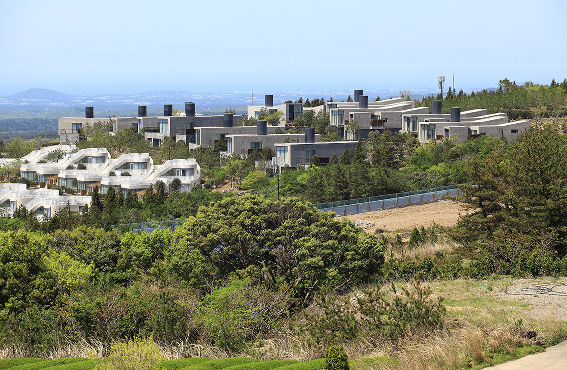
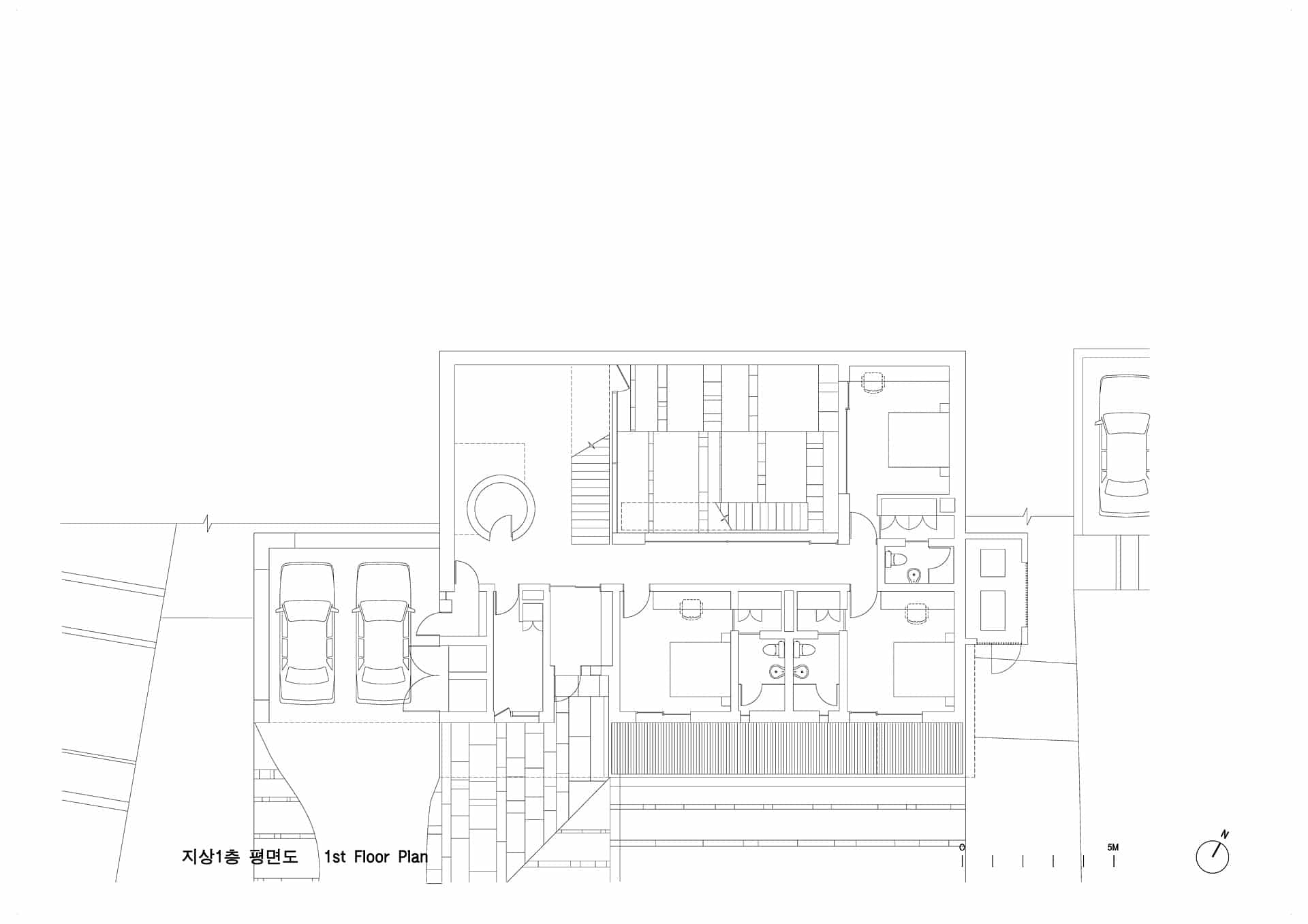
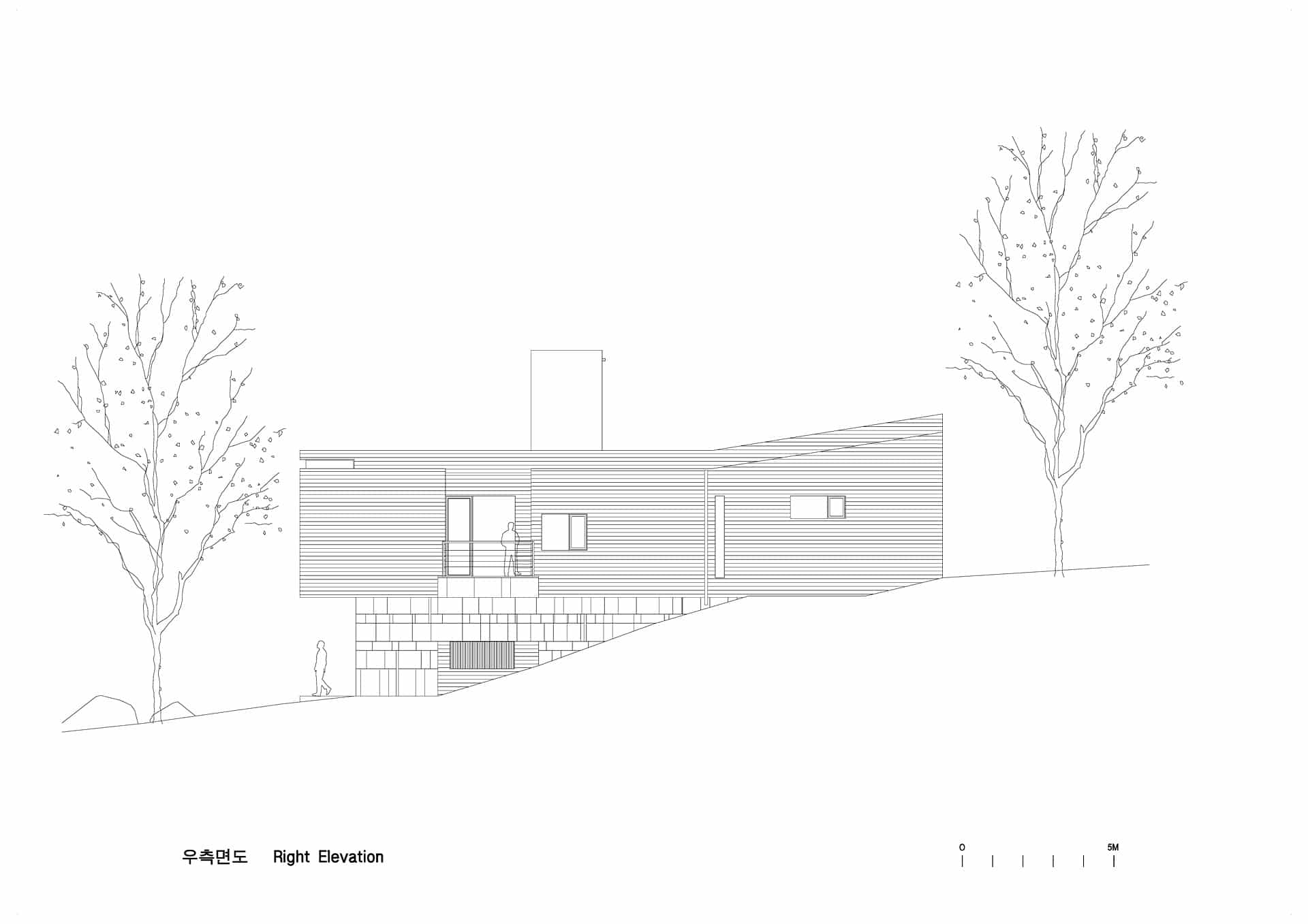
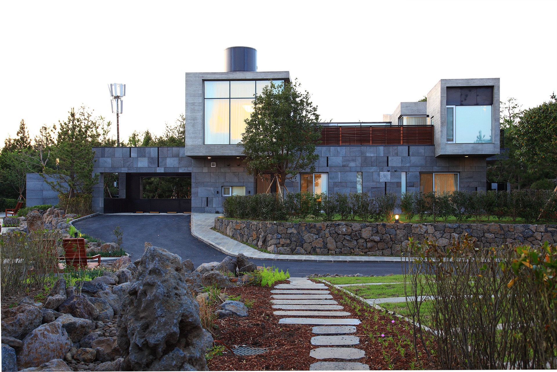
내가 맡은 A블럭은 전체대지의 가장 높은 곳에 위치하므로 아래에서 한라산을 보는 경관을 방해하지 않도록 세대간의 간격을 가장 크게 해야 할 필요가 있어 세로로 긴 평면을 만들 수 밖에 없었다. 한 세대 내에서도 이 흐름이 연결되도록 칸막이가 없는 원룸의 평면으로 만들었다. 그러니 전체적으로 세대 사이로 한라산과 바다를 잇는 풍경이 흐를 뿐 아니라 세대 내에서도 이 풍경의 시퀀스는 유지된다. 풍경의 통로. 이 단어가 주제어였다.
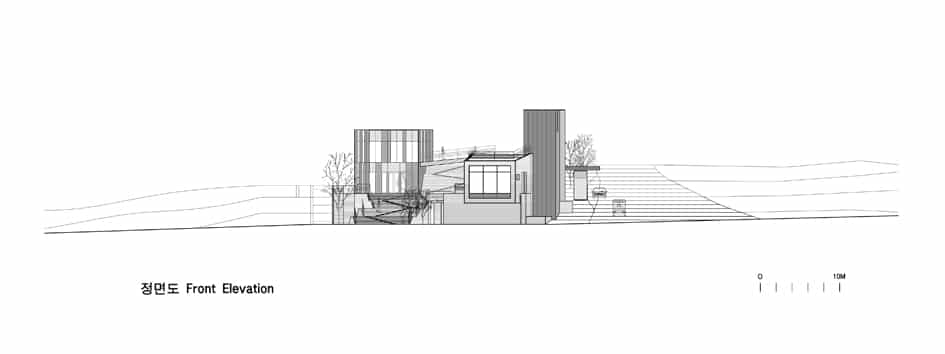
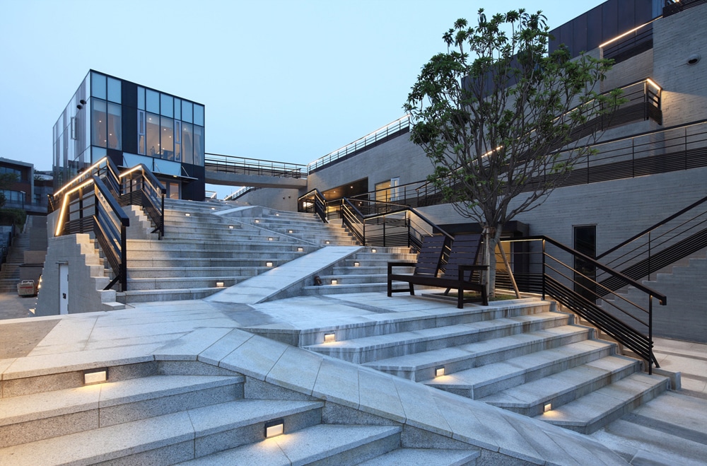
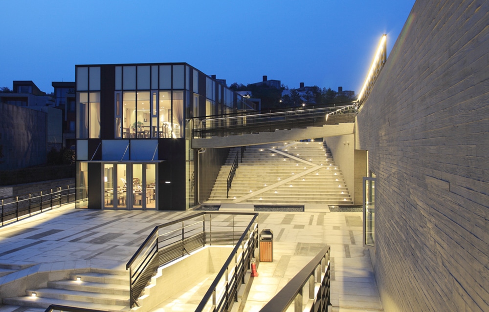
전체 단지의 입구에 위치한 클럽하우스는 더욱 풍경을 주제로 한 건축이 되었다. 동서남북 사방에 서로 다른 레벨의 지면과 면하는 까닭에 이 레벨들을 건축을 통해 유기적으로 연결시켰다. 그래서 지면이 어느새 클럽하우스의 옥상 테라스가 되며 자유스런 출입의 경사로를 따라가다 보면 다른 지면에 다다르고 이윽고 식당으로 마당으로 갤러리로 풀장으로 자연스럽게 연결된다. 지형이 건축을 빚은 것이다. 여기서도 건물의 형태나 상징은 없다. 풍경만이 기억 속에 새겨진다.
The map that best highlights the scenery of Jeju Island is Dae-dong-yuh-ji-do, by Kim Jung Ho. Kim’s map draws the mountain ridge of Mt. Hanla and the valley lines spreading out across the ocean, demonstrating how the topography of Jeju Island should be understood as vertical, not horizontal. The connection between Mt. Hanla and the ocean is the spine of Jeju’s ecology; thus, any architecture that interferes with this link would be in opposition to Jeju. Road 516 follows the perimeter of Jeju, severing the spine of the island’s ecology. The coastal road, which is a non-ecological public work, makes Jeju seem like an island floating in asphalt, not the ocean. Jeju’s fundamental architecture creates a passage connecting Mt. Hanla to the ocean; the architecture is arranged vertically to this line as arranging it to monopolize the view of the ocean not only impedes the flow of nature, but also violates the public nature of the site.
Although DA, which was in charge of the project’s master plan, acknowledged quite a few of my opinions, the limitation of the consultation was evident. Above all, the control of the density was not smooth, making it difficult to create the relaxed atmosphere of a resort town. Consequently, the use of empty passages became critical.
I was in charge of Block A, which is located in the highest part of the region. Gaps between households were maximized so as not to interfere with the view of Mt. Hanla. As a result, it was necessary to create a long vertical plane. A unit was made from the flat plane of a single, non-partitioned room to continue the flow. Overall, the scenery connecting Mt. Hanla and the ocean flows between the units as well as the sequence of the scenery is maintained throughout the house, with the passage of the scenery being the main focus.
The clubhouse located at the entrance of the complex maintained the theme of the scenery. The clubhouse sits upon varying levels of ground extending in all directions. These different levels are organically connected via the architecture. In one area, the ground serves as a roof terrace for the clubhouse. Following up the inclined entrance leads to other grounds; the path continues on to the cafeteria, the yard, the gallery, and the pool. In this way, the topography forms the architecture. The building has no form or symbolization. The only lasting impression is that of the landscape.
